Traffic Forecasting Using Graph Convolutional Network

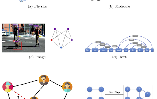
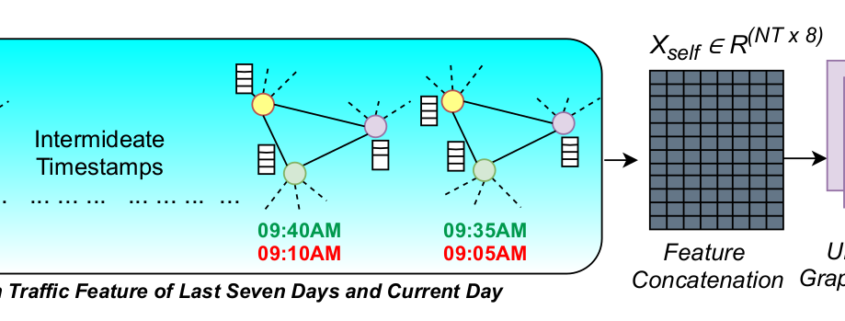
Intelligent Transportation System (ITS) is being developed in many countries around the world and traffic forecasting lies in the heart of ITS. Traffic intensity is determined by the average speed of vehicles passing through observed road junctions in a traffic network at each time interval and the goal of traffic forecasting is to predict the traffic intensity in near future by observing the traffic data from the past and current time along with the physical traffic network. Research in deep learning models to forecast traffic intensities has gained great attention in recent years due to their capability to capture the complex spatio-temporal relationships within the traffic data. However, the task of traffic forecasting is challenging because there lies a complex spatio-temporal relationship in traffic data as the traffic within a busy city changes heavily in different locations throughout different periods in a day. As the traffic junctions and roads between them can be considered as a graph, we employ graph neural networks to model the traffic forecasting problem which have been published in IJCNN 2021 and PAKDD 2021. Also, to capture the repetitive traffic pattern we consider the traffic data of the past few days instead of considering the traffic data of the past day only. With rigorous experiments we have produced better results for accurate traffic forecasting.

Human Activity Recognition and Rehabilitation Exercise Evaluation

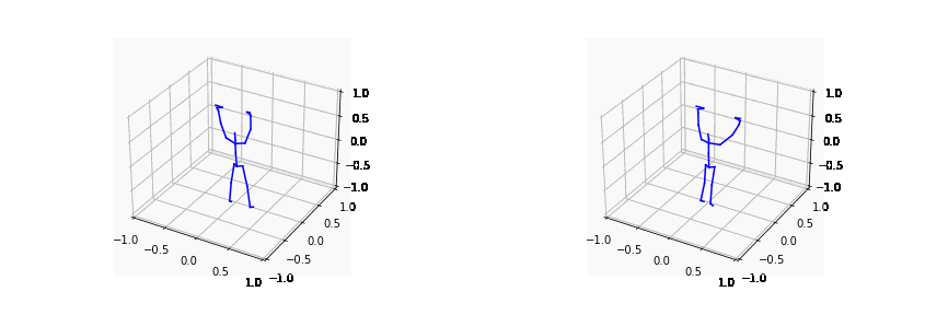
This ICT Division and IUB funded project intends to develop machine learning-based approaches which can be used for the recognition of various activities using data from wearable sensors (e.g. accelerometer, gyroscope) and motion sensing devices (e.g. kinect). In addition, we intend to develop models which could be used by people seeking rehabilitation support at the CRP. Particularly, our research intention is to record movement data while the rehabilitation exercises are performed. In addition to sensor data, the plan includes collection of visual data of the patient performing exercises using 3D sensors. Finally, we intend to use time series data analysis to learn the activity, measure (or grade) the performance of the patient, level of improvement, identify the areas and time when the patient is facing difficulty. In order to achieve automatic or semi-automatic activity recognition and exercise evaluation, we have designed self attention and graph convolution based architectures. The works on self-attention based architectures for activity recognition from sensor data have been published in ECAI 2020 and PAKDD 2021.

Session on Deep Learning Code Management Held at IUB Premises

Recently, a general trend in the machine learning research community is that most of the research papers include links to the code of their experiments. As such, it becomes very much necessary to be able to write DRY, scalable, and modular code that can easily be used to reproduce experimental results. Additionally, it is equally important to be able to tweak the network and dataset parameters with minimal effort, which is critical when performing ablation studies or simply trying to improve the architecture trainable model.

In an endeavor to enlighten the existing and new RAs in this regard, AGenCy Lab of the Centre for Computation and Data Science (CCDS), IUB arranged a deep learning code management session at the IUB premises on May 24, 2022 (Tuesday) at 7 PM. Our RAs Saif Mahmud, Tanjid Hasan Tonmoay, and Mahieyin Rahmun were the speakers in the session. They talked about how SOLID and DRY principles can help in keeping the codebase modular and manageable while at the same time can make working in teams require minimal effort. Managing configuration files, project structuring, logging and visualization, unit testing, and debugging were discussed. Afterward, a short coding session was arranged where the participants were required to code a basic image classification model and apply the concepts they learned from the session. Interested readers can find the presentation slides here.

Understanding the Urban Environment from Satellite Data

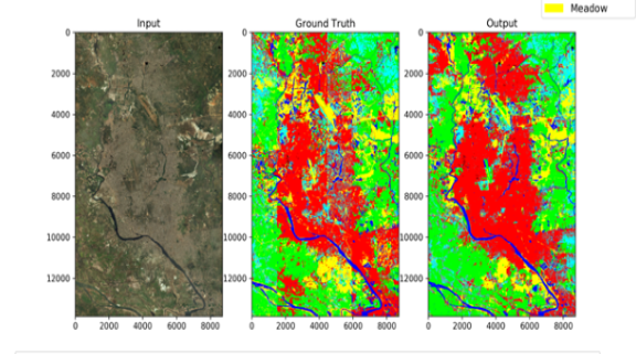
This project is a collaboration between CCDS and the Center for Spatial Information Science, The University of Tokyo, Japan. Based on easily accessible data from Google Earth, this work develops and proposes a new urban environment classification method focusing on formality and informality. The method developed in this work divides the urban environment into 16 categories under four classes. Then it is used to draw the urban environment classes maps of the following emerging cities: Nairobi in Kenya, Mumbai in India, Guangzhou in China, Jakarta in Indonesia, Cairo in Egypt, and Lima in Chile. The characteristics of the different urban environments and the differences between the same class in different cities are investigated. The paper also demonstrate the agility of the proposed method by showing how this classification method can be easily augmented with other data such as population per square kilometer to aid the decision-making process.

Paper published at Sustainability 2022, MDPI

As a joint collaboration between Data and Design Lab and AGenCy Lab with Center for Spatial Information Science (The University of Tokyo) the paper titled “Understanding the Urban Environment from Satellite Images with New Classification Method—Focusing on Formality and Informality” has been published in Sustainability, MDPI.

Based on easily accessible data from Google Earth, this work develops and proposes a new urban environment classification method focusing on formality and informality. Firstly, the method gives a new model to scrutinize the urban environment based on the buildings and their surroundings. Secondly, the method is suited for the state-of-the-art machine learning processes that make it applicable and scalable for forecasting, analytics, or computational modeling. The paper first demonstrates the model and its applicability based on the urban environment in the developing world. The method divides the urban environment into 16 categories under four classes. Then it is used to draw the urban environment classes maps of the following emerging cities: Nairobi in Kenya, Mumbai in India, Guangzhou in China, Jakarta in Indonesia, Cairo in Egypt, and Lima in Chile. The characteristics of the different urban environments and the differences between the same class in different cities are presented. The paper also demonstrate the agility of the proposed method by showing how this classification method can be easily augmented with other data such as population per square kilometer to aid the decision-making process.

AGenCy Lab Meetup

We had the CCDS / AGenCy lab’s big meetup on the fine morning of March 8th. The new faculty members Dr. M M Mahbubul Sayeed, Dr. Asm Shihavuddin and Dr. Saadia Binte Alam who joined IUB this year, the current faculty members – Prof Arshad Momen, Prof Ashraful Amin, Dr. Amin Ahsan Ali and Dr. AKM Mahbubur Rahman, the outgoing RAs, the new RAs, and the undergrads who are doing their senior project with us were present. We had a special session conducted by our outgoing RAs who received PhD admission with RAships/fellowships sharing their research experience and journey towards PhD admission. Special thanks to Amit Roy, Kashob Roy , Saif Mahmud Dhrubo and Tanjid Hasan Tonmoy, Fahim Faisal Niloy for sharing their PhD admission experience.